My streak of “bad” timing continues, in Cuenca, Spain.
I’ve mentioned before about my innate ability to visit places at a time when their greatest monument is shrouded in scaffolding. Not really a “gift” for a travel photographer, but it’s something I’ve come to deal with and it has taught me to focus on finding the other hidden gems in a community, which can often be better in terms of stock photography sales due to there being less competition in the photo files.
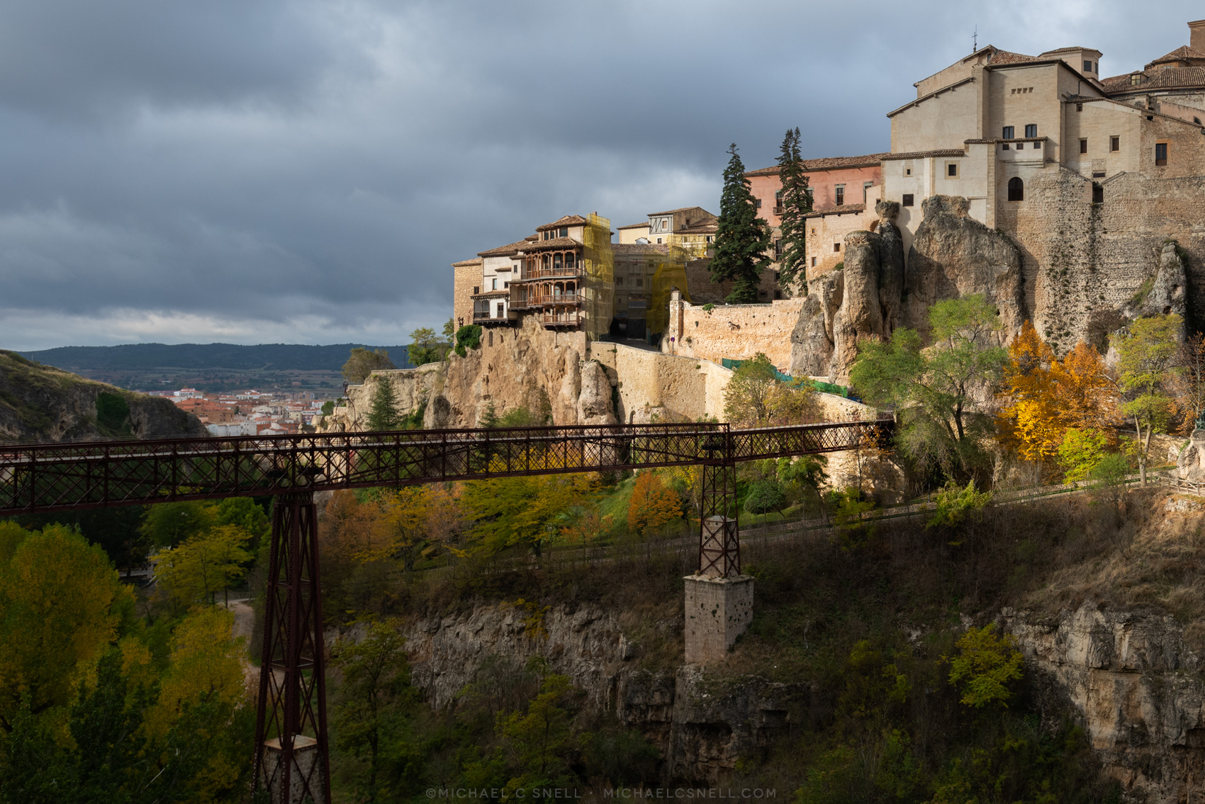
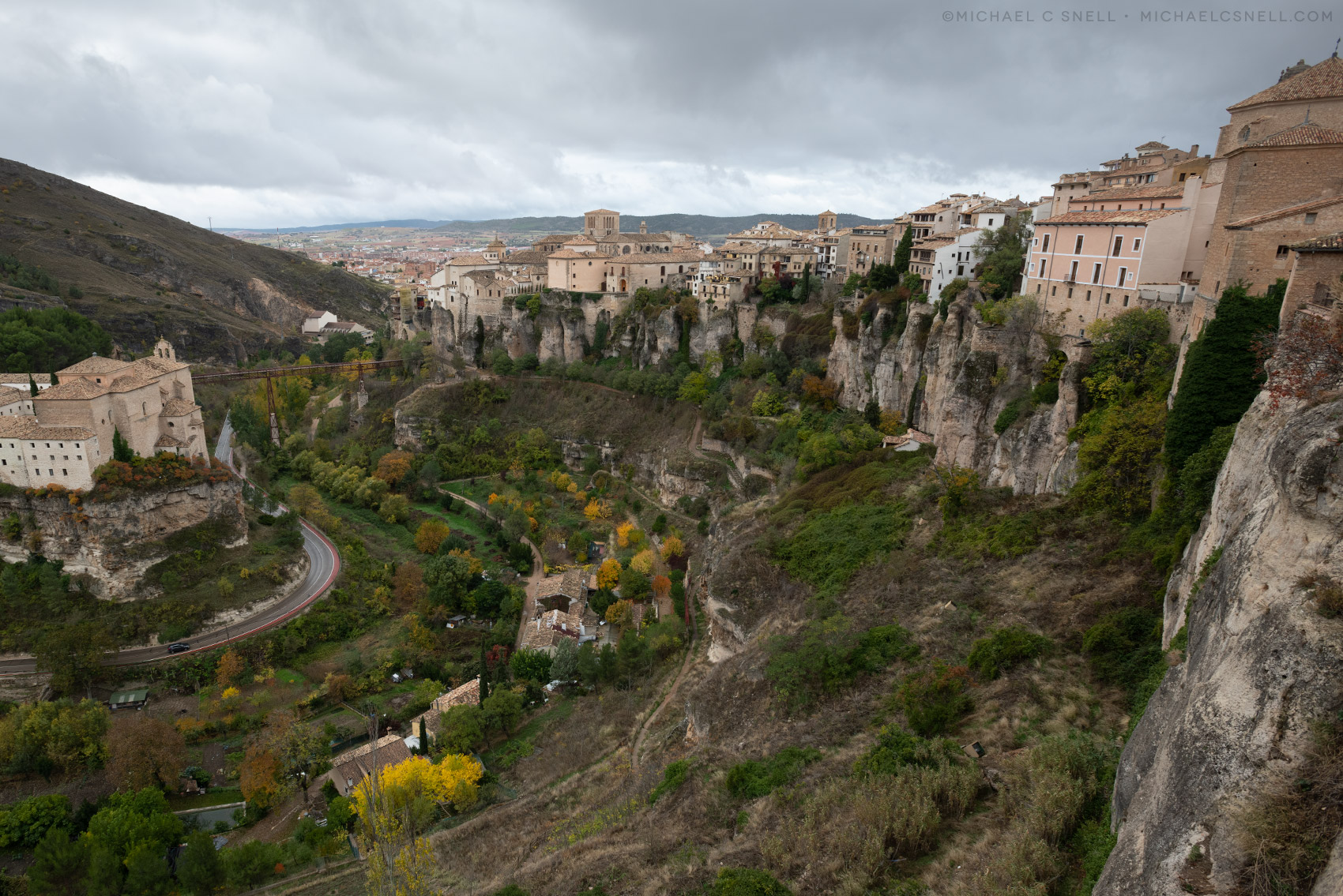
Well, I found myself with a few days between engagements in Spain, following the Saffron Festival trip, and decided to book a room at the Parador in Cuenca. The Old Town of Cuenca is built on a narrow, rocky ridge between two river gorges. A fortress (called Kunka) was built on this site in 714 for the defensible nature of the ridge. The Old Town sits about 150 feet above the lower valley, if my math skills are up to the task of reading the elevations correctly.
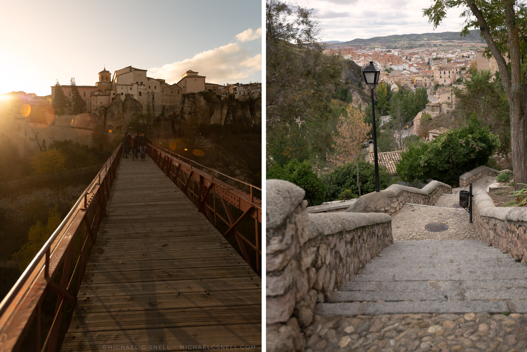
The Parador (one of a State-run chain of hotels — see my e-book) is housed in a former convent on opposite side of the gorge formed by the Huécar River. To get from the Parador into the Old Town, you cross an ancient foot bridge that spans the gorge as seen in the photo above (the photo is actually take from the Parador, giving you some idea of the setting). The footbridge is that metal truss bridge — a replacement for an earlier stone arched bridge that used the same piers.
At least that’s how you usually get across the gorge. I managed to arrive at a time when the road on the Old Town side of the foot bridge was closed for some repairs. I could still get across the gorge, but once on the town side, I had to choose one of two routes shown in the map below:
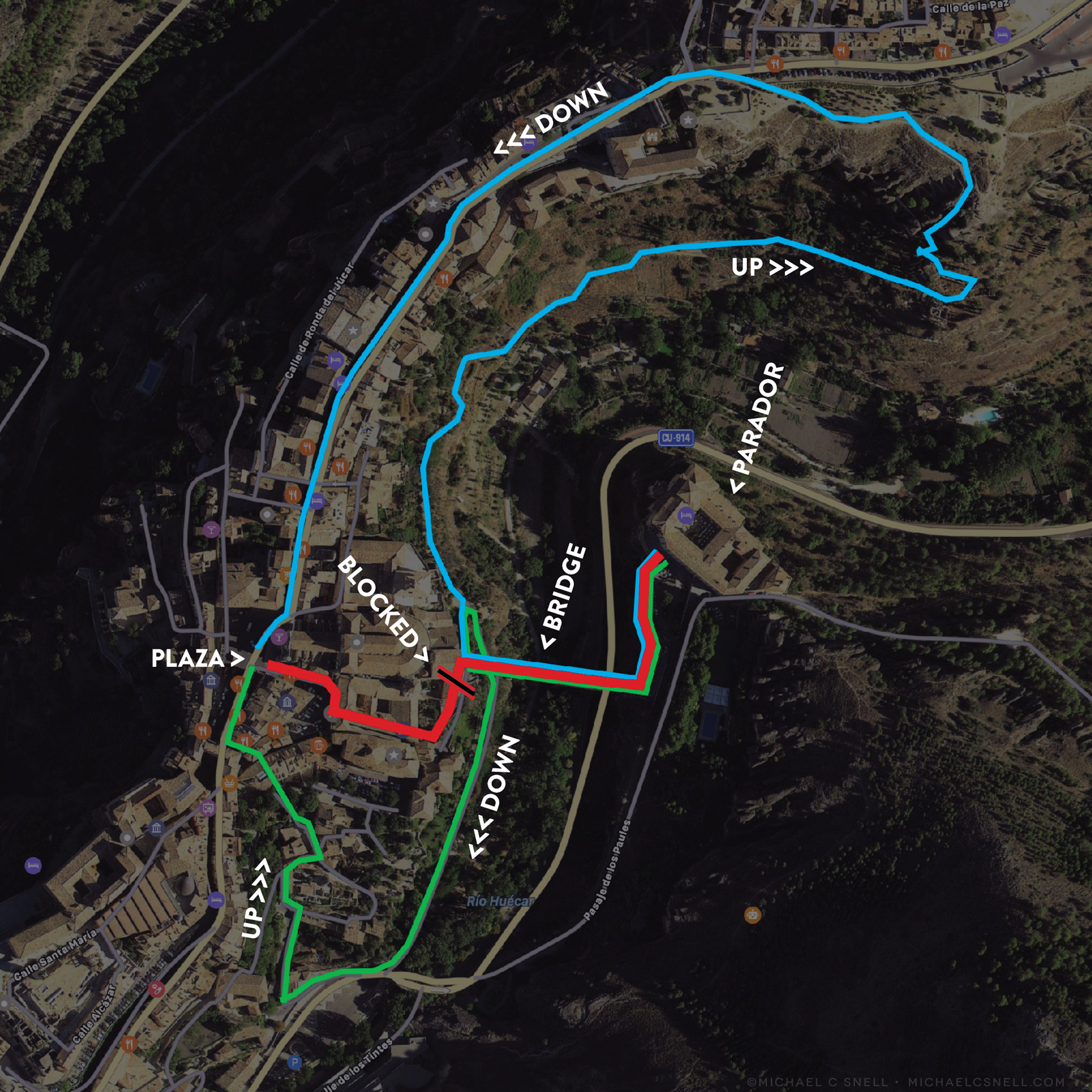
The red line shows the normal route from the Parador to Cuenca’s Plaza Mayor. The green and blue lines show the two options I had for getting to town (on foot) during the closing of the main route. Sure, I could have taken a taxi around — they were easily available and not at all expensive — but I usually prefer walking so that I can take advantage of photo opportunities that may arise en route.
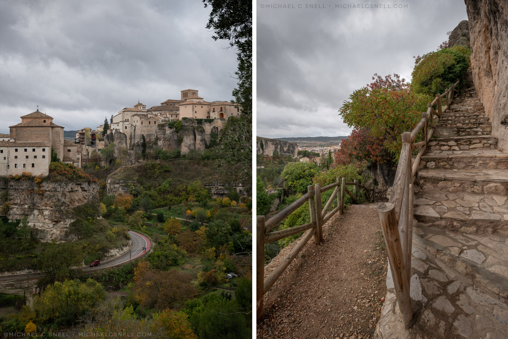
The green line became my usual route. Once across the bridge, there was a trail that spiraled around and back under the footbridge that went steeply down the side of the gorge to the river below. After a short piece along the river’s course, you could turn right and start your way back up using a series of steep cobbled streets and staircases. It was a workout, to be sure, but it was quite scenic.
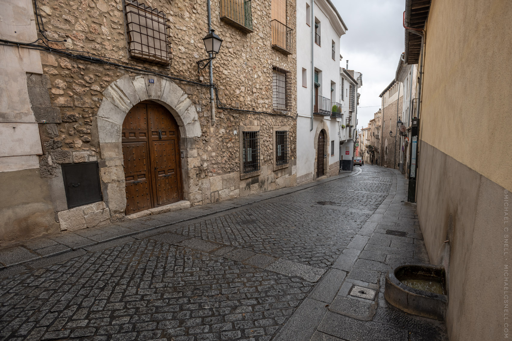
More scenic, but less convenient, is the route I’ll share today via some photos. Once again, the walk across the footbridge remained the same, but instead of spiraling back under it, a rougher path continued north, perched along the side of the gorge.
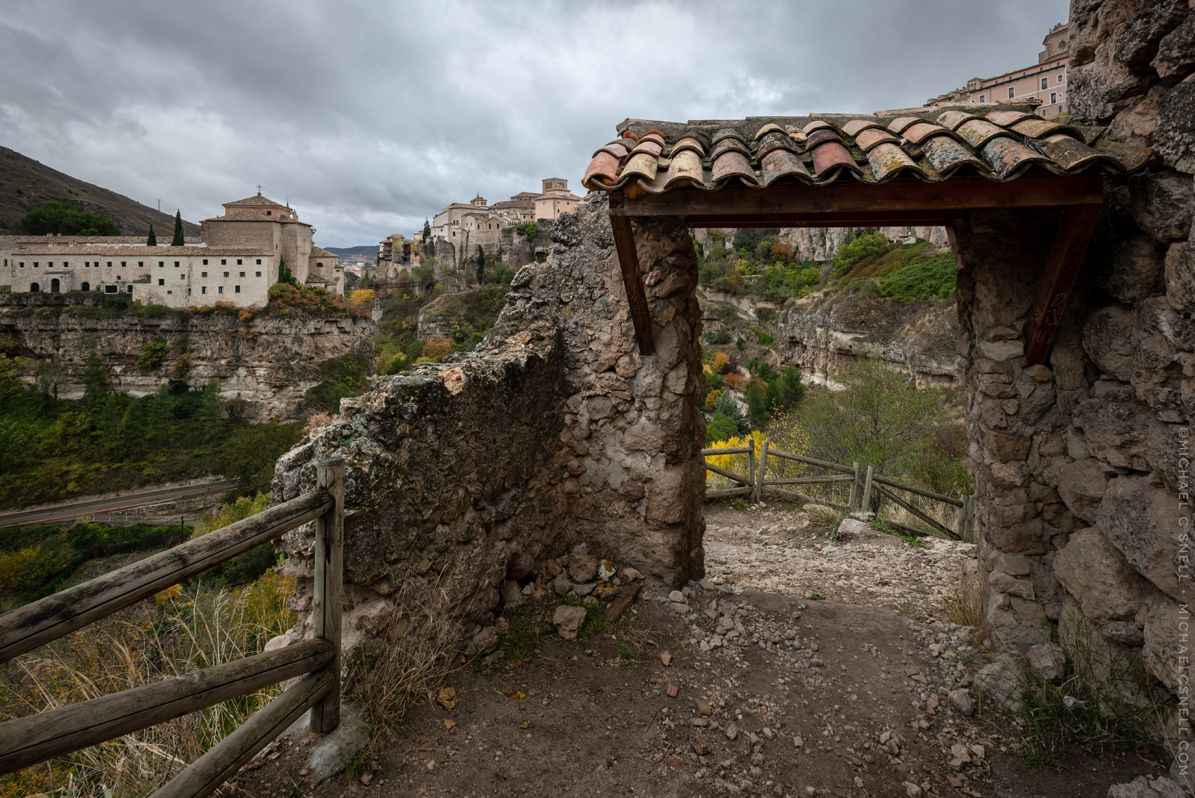
This is the view back after going some distance up the trail. The Parador is the large building on the left and you can just make out the footbridge to the right of it in the distance. For reference, here’s a shot from the footbridge, with the Parador (actually the museum attached to the side of the Parador) on the right. You can make out the gate from the above photo to the left of the building, along the path and just below the tall, thin cypress trees.
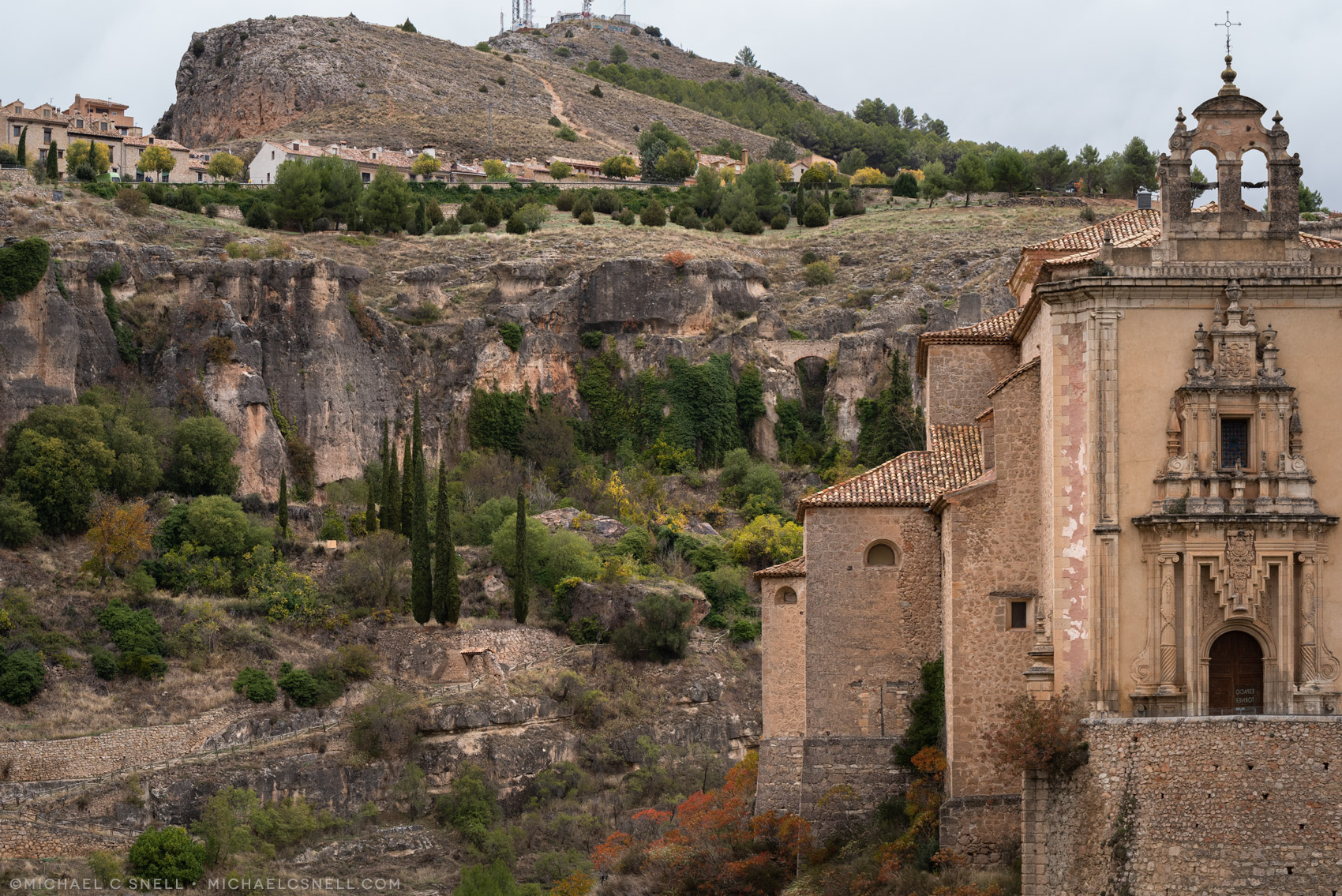
Further along the trail, there were spectacular views back toward the Parador. Eventually, the path turned into a series of switchback stairs that led up the last portion of the gorge, where the views were also amazing. This area is very close to a parking area and overlook so you could easily get here by car, but where’s the fun in that?
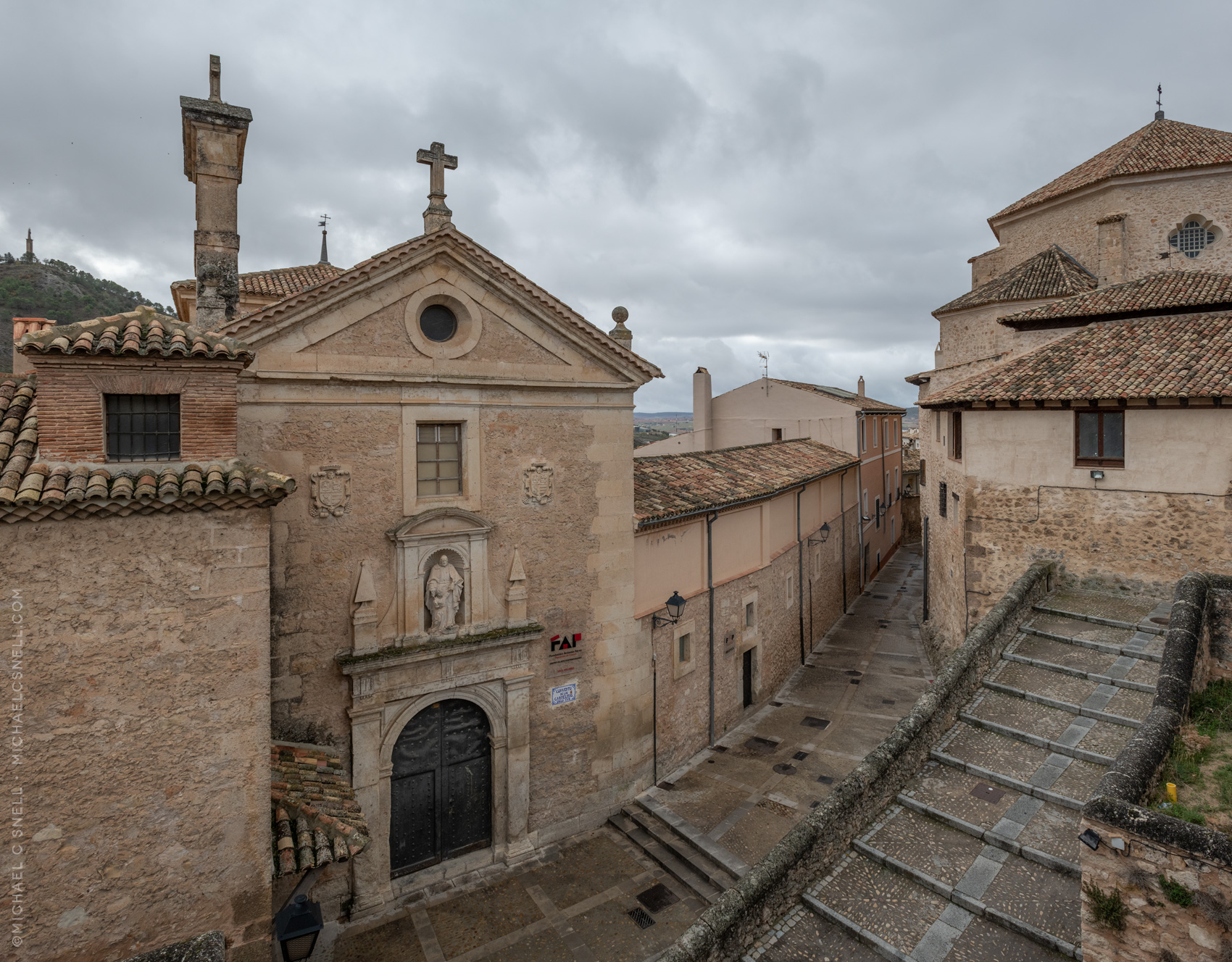
Once on top of the cliff, you find yourself in civilization again. Along the parking for the overlook are a line of restaurants, bars and little shops. Turning back toward the main plaza, you pass through the city gate and past the old Carmelite Convent, seen above.
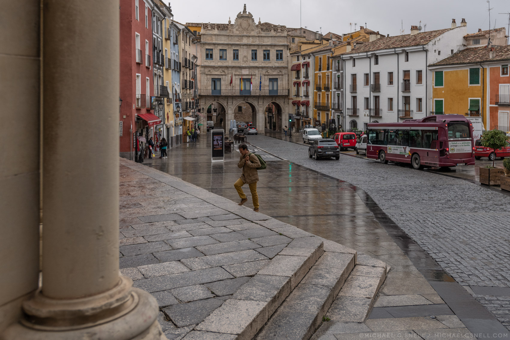
It’s pretty much impossible to get lost on your way to the Plaza Mayor from here. The old part of Cuenca is largely one street that follows the crest of the ridge between the two rivers. Occasionally the ridge widens enough for there to be a second street, but it will surely run parallel to the main road and rejoin it further on. It’s a bit downhill now, which is a relief, and eventually you will find yourself in the Plaza Mayor in front of Cuenca’s cathedral.
It was a bit of a drizzly, rainy day when I made this hike, but — so that you don’t think it’s dreary in Cuenca all the time — I’ll leave you with one more photo taken on a sunnier day that gives you some idea of how idyllic this ridge-top location really is. I don’t regret taking these longer hikes into town as they always revealed something new. In the next post I’ll delve a little more into Cuenca’s one main road, which I got to know very well, walking the length of it several times over my few days there. For now, enjoy the view of the Júcar River gorge on the other side of Cuenca’s ridge, just steps off of the Plaza Mayor:


Thank you, Michael. That was a peaceful, pastoral nice change of pace.
I am from Castilla-La Mancha and I really love your work. Your photos are totally wonderful. Thank you so much for being interested in our land and sharing these beautiful corners with the world in your great gallery 🙂
Just gorgeous! Thanks!